





A geotechnical report is a foundational engineering document that translates subsurface soil conditions into specific design parameters required for safe, code-compliant construction. Understanding how a geotechnical report is used in design separates projects that proceed on schedule and budget from those that face costly redesigns mid-construction. Building codes including the International Building Code and ASCE 7 standards require geotechnical data to govern foundation selection, seismic design categories, and site grading. For property owners, developers, and construction professionals, the geotechnical report is not a formality. It is the primary technical input that shapes every major structural decision on a project.
How is a geotechnical report used in design?
A geotechnical report provides the subsurface data that engineers translate directly into design criteria. Without it, structural and civil engineers are making assumptions about the ground. Those assumptions carry significant financial and safety risk.
The report delivers several critical parameters that drive design decisions across disciplines:
- Allowable bearing capacity: This value determines whether shallow foundations such as spread footings or slabs-on-grade will perform adequately, or whether deep foundations such as driven piles or bored piles are required. Foundation design soil data directly governs structural sizing and cost.
- Settlement estimates: Differential settlement causes cracking, serviceability failures, and long-term structural damage. The report quantifies expected settlement under load so engineers can design accordingly.
- Groundwater levels: Groundwater depth affects excavation methods, dewatering requirements, and waterproofing specifications. Ignoring groundwater data leads to flooded excavations and failed basement slabs.
- Lateral earth pressures: Retaining wall design depends on active and passive earth pressure coefficients derived from soil classification and shear strength data.
- Site class and seismic parameters: Geotechnical reports include site class, spectral accelerations, and seismic design category under ASCE 7. These values determine lateral force demands on the entire structural system.
- Corrosivity and expansion indices: Expansive soils cause slab heave and foundation movement. Corrosive soils accelerate deterioration of concrete and steel. The report flags both conditions and recommends material specifications.
Pro Tip: Never read the bearing capacity value in isolation. A high bearing capacity on paper can still produce unacceptable settlement if the soil layer is thin or underlain by compressible material. Always cross-reference bearing capacity with settlement predictions before selecting a foundation type.
The geotechnical report also defines soil classifications per USCS (Unified Soil Classification System) or AASHTO standards, which inform compaction specifications for earthworks and subgrade preparation. Building codes require geotechnical data especially in expansive soil zones and seismic hazard areas, where inadequate subsurface investigation has historically caused structural failures.
| Design Element | Geotechnical Parameter Used |
|---|---|
| Foundation type selection | Allowable bearing capacity, settlement estimates |
| Retaining wall design | Lateral earth pressure coefficients, soil friction angle |
| Seismic structural design | Site class, spectral accelerations, seismic design category |
| Slab and pavement design | Expansion index, compaction requirements, subgrade modulus |
| Excavation and waterproofing | Groundwater depth, permeability, dewatering recommendations |

When should you commission a geotechnical investigation?
Timing is as critical as the data itself. Early geotechnical involvement replaces guesswork with evidence and enables coordinated budget and design decisions before commitments are made. Late commissioning is one of the most common and expensive mistakes on construction projects.
The recommended sequence follows a clear order of operations:
- Desktop study at pre-offer or feasibility stage: Review existing geological maps, historical borehole records, and aerial photography. This costs approximately $2,500 and identifies red flags before land acquisition.
- Intrusive investigation during due diligence: Commission borehole drilling, standard penetration tests, and laboratory analysis. Detailed investigations typically cost $15,000–$60,000 depending on site complexity and depth. This investment is a small fraction of total project value.
- Supplemental testing at design phase: Address specific design questions such as pile load testing, permeability testing for drainage design, or Dynamic Cone Penetrometer testing for pavement subgrade.
Late geotechnical commissioning creates cascading problems. Structural engineers select foundation systems without verified soil data. Civil engineers design grading and drainage without confirmed groundwater levels. When the actual report arrives and contradicts design assumptions, change orders follow. Early geotechnical investigation identifies soil uncertainties such as groundwater variations and variable soil layers that cause costly delays when discovered during construction.
Report currency matters as well. Most professional jurisdictions require geotechnical reports to be current, typically within 2–5 years, or accompanied by a professional letter confirming applicability to the current project scope. Submitting an outdated report to a building authority causes permit rejection and schedule delays.
Pro Tip: If you acquire a site with an existing geotechnical report, do not assume it covers your project. Verify that the investigation locations, depths, and scope match your proposed structure’s footprint and load conditions. A geotechnical engineering consultant can confirm applicability in a single review meeting.
Coordination between geotechnical, civil, and structural engineering teams must happen at the design kickoff. Design coordination challenges multiply when geotechnical data arrives after structural framing decisions are already locked in.
How to interpret geotechnical data for design purposes
Interpreting a geotechnical report requires more than reading the executive summary. The executive summary presents conclusions, but the body of the report contains the data that engineers must verify against their specific design conditions.
Key steps for verifying report adequacy:
- Check investigation coverage: Confirm that borehole or test pit locations cover the full building footprint, not just one corner of the site. Soil conditions vary laterally, and a single borehole does not characterize an entire site.
- Verify investigation depth: Boreholes must extend below the zone of influence of the proposed foundation. For deep foundations, this means drilling well past the anticipated pile tip elevation.
- Identify missing parameters: Confirm the report includes all parameters your structural and civil engineers need. Missing lateral earth pressure data, expansion index values, or seismic site class information requires supplemental testing before design can proceed.
- Assess geohazard disclosures: Reports must identify expansive clay, karst terrain, liquefiable soils, or contamination. If a report does not address geohazards present in the regional geology, treat it as incomplete.
A common and costly misconception is that higher bearing capacity always reduces foundation costs. Settlement risk and excavation requirements must be evaluated together with bearing capacity to avoid serviceability failures and unexpected construction costs.
Undisturbed soil strength data typically starts 2 feet below the surface. For pavement and working surface design, Dynamic Cone Penetrometer testing and other near-surface tests must supplement standard borehole data. Relying solely on deeper borehole results for shallow pavement design produces inaccurate subgrade modulus values and premature pavement failure.
| Report Condition | Design Risk | Recommended Action |
|---|---|---|
| Single borehole for large site | Missed soil variability | Request additional investigation points |
| No expansion index reported | Slab heave risk in clay soils | Commission laboratory swell testing |
| Groundwater not measured | Excavation and waterproofing errors | Install monitoring wells or request wet season data |
| Report older than 5 years | Permit rejection, outdated conditions | Commission new investigation or obtain PE confirmation letter |
| No seismic site class stated | ASCE 7 compliance gap | Request geotechnical engineer addendum |
Understanding a report’s limitations section is equally critical. Geotechnical engineers state the assumptions and boundaries of their investigation. Designers who ignore the limitations section and apply report data beyond its stated scope take on unquantified risk.
How do geotechnical findings translate into specific design outcomes?
The direct application of geotechnical data in design is where the report’s value becomes concrete. Each major design discipline draws specific inputs from the report.
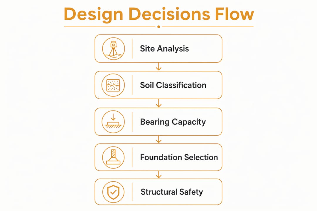
Foundation design is the most direct application. Bearing capacity and settlement data determine whether a project uses shallow or deep foundations. Geotechnical reports provide the soil parameters that structural engineers use to size footings, select pile types, and specify pile depths. A site with low bearing capacity and high settlement risk in the upper soil layers will require deep foundations regardless of the structural loads, because the soil simply cannot support a shallow system without unacceptable movement.
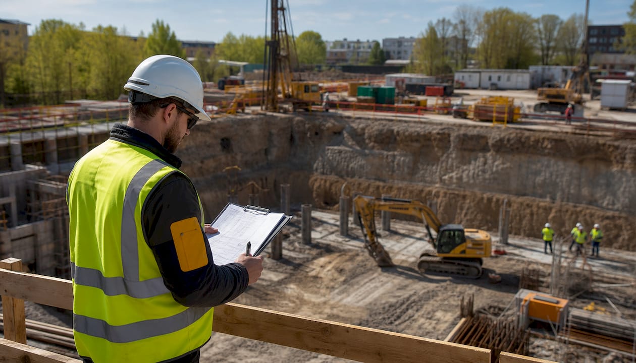
Site grading and earthworks rely on compaction specifications and moisture conditioning recommendations from the report. Earthworks compaction standards specify compaction percentages and moisture ranges that contractors must achieve during fill placement. Failing to meet these specifications produces weak subgrades that cause pavement failures and building settlement after construction.
Drainage design depends on soil permeability values and groundwater data. A site with low-permeability clay soils requires different drainage infrastructure than a site with free-draining sandy soils. Undersized drainage systems on clay sites cause ponding, slope instability, and foundation saturation.
Seismic design uses site class and spectral acceleration values from the geotechnical report as direct inputs to structural analysis under ASCE 7. A site classified as Site Class E or F, indicating soft soils, amplifies ground motion significantly compared to rock sites. That amplification increases lateral force demands on the structural frame, shear walls, and connections. The role of geotechnical analysis in design is therefore not limited to the foundation. It propagates through the entire structural system.
Material selection is also informed by the report. Corrosive soils require sulfate-resistant cement mixes and coated or cathodically protected steel. Expansive soils require post-tensioned slabs or stiffened raft foundations rather than conventional slabs-on-grade. These material decisions affect both construction cost and long-term maintenance obligations. Understanding the building services risk profile of a site, including soil-driven risks, helps developers quantify total project exposure before committing to a structural system.
Key Takeaways
A geotechnical report is the primary technical document that converts subsurface conditions into specific design criteria governing foundation type, structural system, grading, drainage, and material selection across every discipline on a construction project.
| Point | Details |
|---|---|
| Report drives foundation selection | Bearing capacity and settlement data determine whether shallow or deep foundations are required. |
| Seismic parameters come from the report | Site class and spectral accelerations under ASCE 7 directly set lateral force demands on the structure. |
| Timing determines cost exposure | Commissioning investigations at feasibility stage prevents redesign costs and change orders during construction. |
| Report currency affects permitting | Most jurisdictions require reports within 2–5 years; outdated reports cause permit rejection and delays. |
| Interpretation requires full-report review | Reading only the executive summary misses limitations, soil variability data, and missing parameters that affect design accuracy. |
What I have learned from years of working with geotechnical reports
The single most consistent mistake I see developers make is treating the geotechnical report as a box to check for permit submission rather than a design input to act on. They receive the report, file it, and let the structural engineer work from the summary page. That approach costs money.
The reports that actually protect a project are the ones that get read in detail by the structural engineer, the civil engineer, and the project manager together. When all three disciplines review the same report at the same time, conflicts between design assumptions surface before they become change orders. I have seen projects where the structural engineer assumed one groundwater level and the civil engineer assumed another, simply because they read different sections of the same report without cross-checking.
The other misconception I encounter regularly is that a geotechnical report from a neighboring site or a previous project on the same land is sufficient. Soil conditions change with depth, with seasonal groundwater fluctuation, and with any prior earthworks on the site. A report that is five years old and predates site grading or demolition work does not reflect current conditions. Commissioning a fresh investigation, or at minimum obtaining a professional engineer’s written confirmation of applicability, is not optional. It is the minimum standard of due diligence.
The firms that manage geotechnical risk well treat the report as a living reference document throughout design and construction, not a one-time deliverable. That discipline separates projects that finish on budget from those that do not.
— Aman
Geotechnical expertise built into your design process
Geotechnical data only protects your project when it is correctly integrated into structural and civil design from the start. Stellar Structures provides civil and structural design checks that verify your design assumptions align with the geotechnical report’s recommendations, covering foundation sizing, earthworks specifications, seismic parameters, and material requirements.

The team at Stellar Structures coordinates directly with geotechnical engineers to confirm that report findings are correctly applied across all design disciplines. Whether your project is at feasibility, detailed design, or construction documentation stage, Stellar Structures delivers design reviews that reduce risk, support authority submissions, and keep your project on schedule.
FAQ
What does a geotechnical report include?
A geotechnical report includes allowable bearing capacity, settlement estimates, groundwater levels, lateral earth pressures, soil classifications, seismic site class, spectral accelerations, and earthworks compaction recommendations. These parameters directly inform foundation, structural, and civil design decisions.
How current does a geotechnical report need to be?
Most professional jurisdictions require geotechnical reports to be within 2–5 years of the project submission date, or accompanied by a professional engineer’s letter confirming the report’s applicability to the current project scope and conditions.
Can you reuse a geotechnical report from a previous project on the same site?
Reusing an existing report is only acceptable if a licensed geotechnical engineer confirms in writing that the investigation scope, depth, and findings apply to the current project’s footprint and structural loads. Any prior earthworks, demolition, or changes in groundwater conditions typically require a new investigation.
Why does geotechnical data affect seismic structural design?
Site class and spectral acceleration values from the geotechnical report are direct inputs to ASCE 7 seismic analysis. Soft soil sites amplify ground motion, which increases lateral force demands on the structural frame, shear walls, and connections throughout the building.
When is the right time to commission a geotechnical investigation?
The most cost-effective approach is a desktop study at feasibility, followed by intrusive investigation during due diligence, and supplemental testing at the detailed design phase. Commissioning investigations after structural design begins increases the risk of costly redesign when actual soil conditions differ from assumptions.
Recommended
- Value Engineering Deep Excavations: Smart Steel Strutting Design
- Singapore Foundation Engineering Guide 2025: Geotechnical design, cost, and structural systems
- When You Need a Geotechnical Engineering Consultant – Stellar Structures
- Geotechnical engineer’s role in building projects